
 Rock art figures created by ancient Native Americans can be seen in several places in Capitol Reef National Park. Most are attributed to the Fremont Culture, which existed in areas of Utah from approximately AD 600 to 1300. The Fremont people were contemporaries of the Ancestral Puebloans (Anasazi) of the Four Corners area.
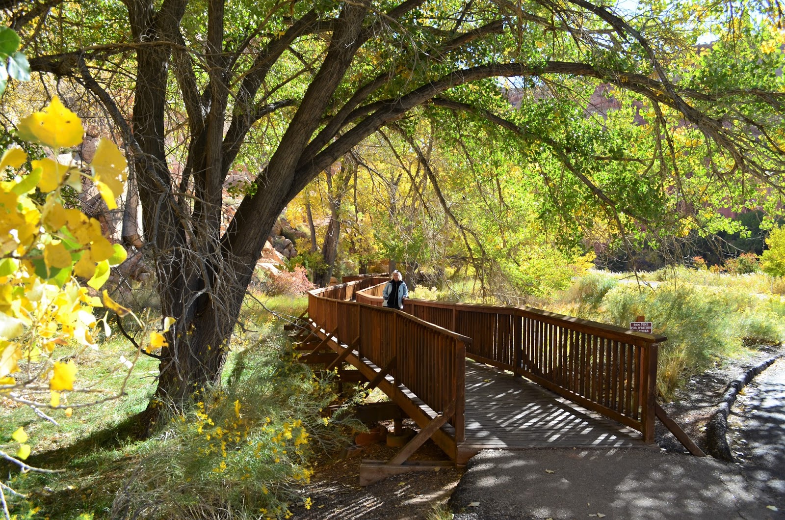
  Very impressive petroglyph figures can be seen along a sheer cliff that parallels Hwy 24 just east of the Visitor Center in Capitol Reef. The figures cover several rock panels and the diversity of images is astonishing. A road sign identifies the area, which includes a parking turnout. Boardwalks and viewing platforms have been established to make it easy for visitors to see the figures.
(Click on photos to enlarge)


 Fremont pictographs (painted on rock surfaces) and petroglyphs (carved or pecked into the rock) depict people, animals and othe r shapes and forms. Anthropomorphic (human-like) figures usually have trapezoidal shaped bodies with arms, legs and fingers. The figures are often elaborately decorated with headdresses, ear bobs, necklaces, clothing items and facial expressions. A wide variety of zoomorphic (animal-like) figures include bighorn sheep, deer, dogs, birds, snakes and lizards. Abstract designs, geometric shapes and hand prints are also common.


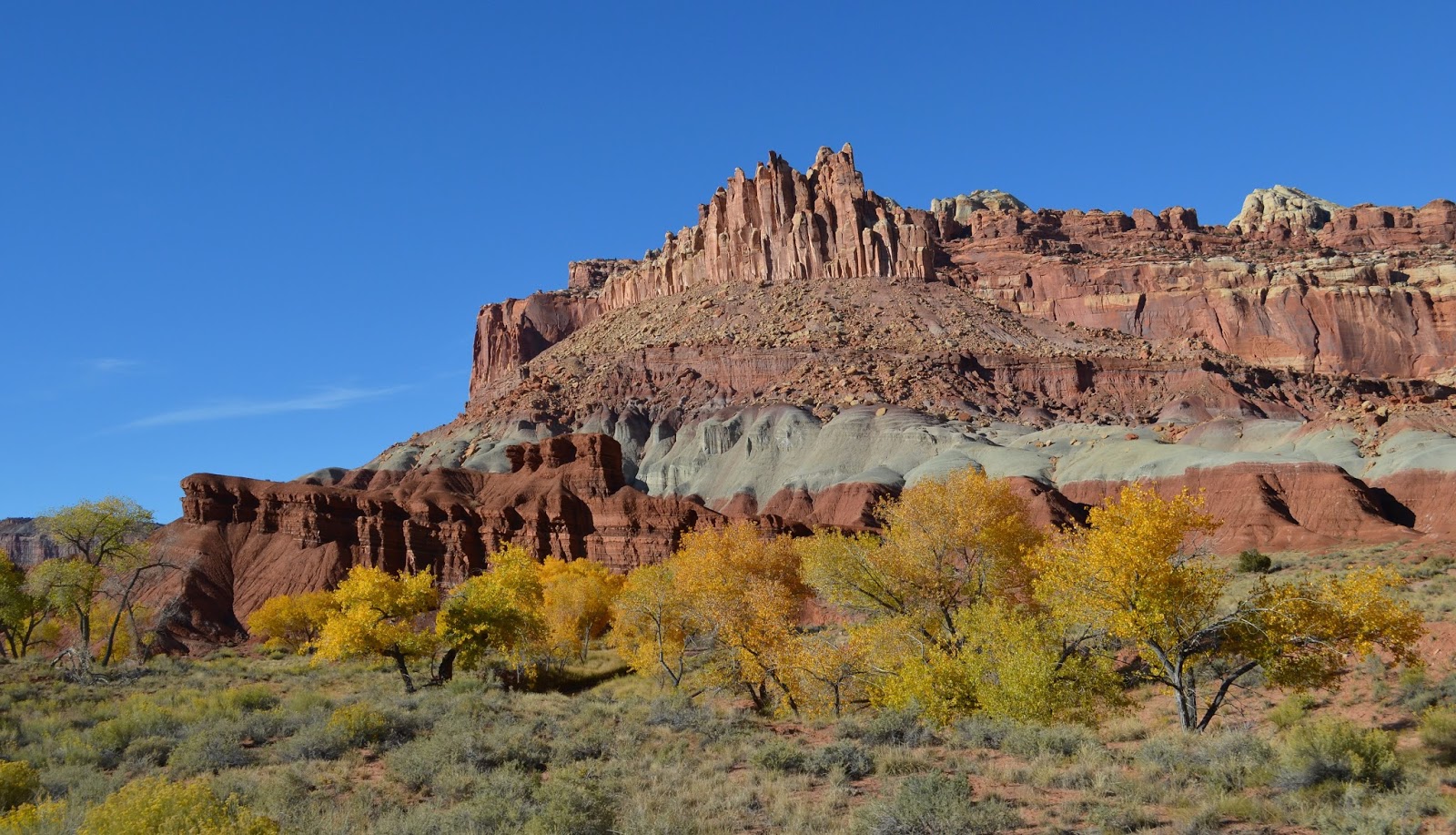
 Just beyond is a good overlook of the Fremont River valley and distant lands to the west, while all around are eroded rock formations of many colors, with larger domed summits in the distance.


I grabbed our cooler bag out of the back of the truck and we drove just a little further up the highway to another pull-out with a view to eat our lunch.


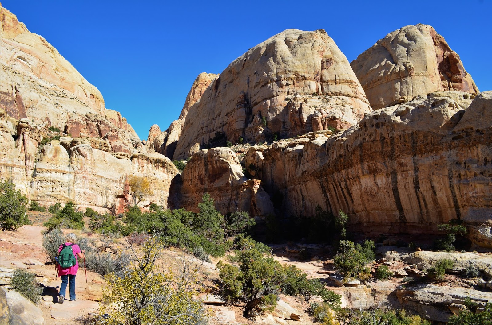
 Connecting Highway 24 and the Fremont River with the Scenic Drive, Grand Wash is one of only six drainages cutting east-west through the 100-mile Waterpocket Fold. It also happens to be one of the flattest and easiest hikes in Capitol Reef National Park. The scenic walk, a great option for children or those looking for a casual stroll, follows the wide and dry
  creek bed for nearly 2 ½ miles through sinuous curves and three different layers of rock: the towering white cliffs of Navajo sandstone, the ledgey Kayenta formation, and the deep red Wingate sandstone. In the ½ mile-long narrows section, the varnished canyon walls reach as far as 500 feet high; the pearly white cliffs beyond reach even higher. It’s therefore no wonder that Grand Wash is one of Capitol Reef’s most popular hikes.


 The wash cuts right through the reef, has sheer cliffs of Wingate and Navajo sandstone up to 500 feet high, many colorful strata and eroded rock formations, with a short, enclosed section of the streamway where the walls are less than 15 feet apart and the waters, when flowing, cover all of the canyon floor.


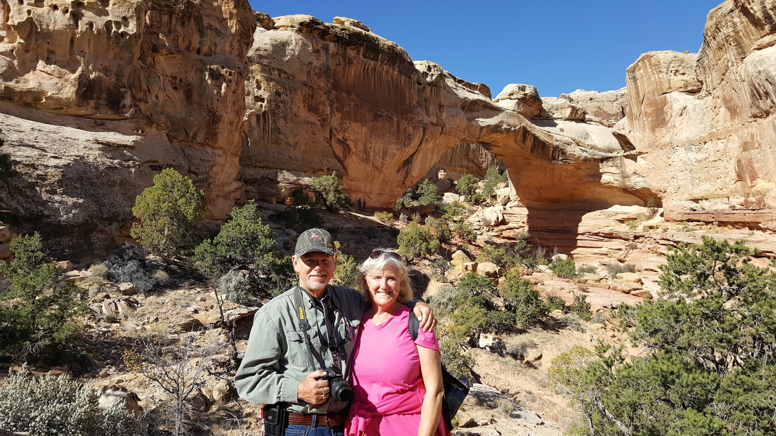
 We turned around just past the turnoff for the trail up to Cassidy Arch which is just before the end of the Grand Wash trail (near the parking lot off the Scenic Drive). Although we would love to see it, Cassidy Arch was another 1.5 miles (with an elevation change of 670 feet!). That would add another 3 miles to our hike. This was already our second hike of the day and we still had to hike back to the truck...so we decided against it. We'll have to see it another time.
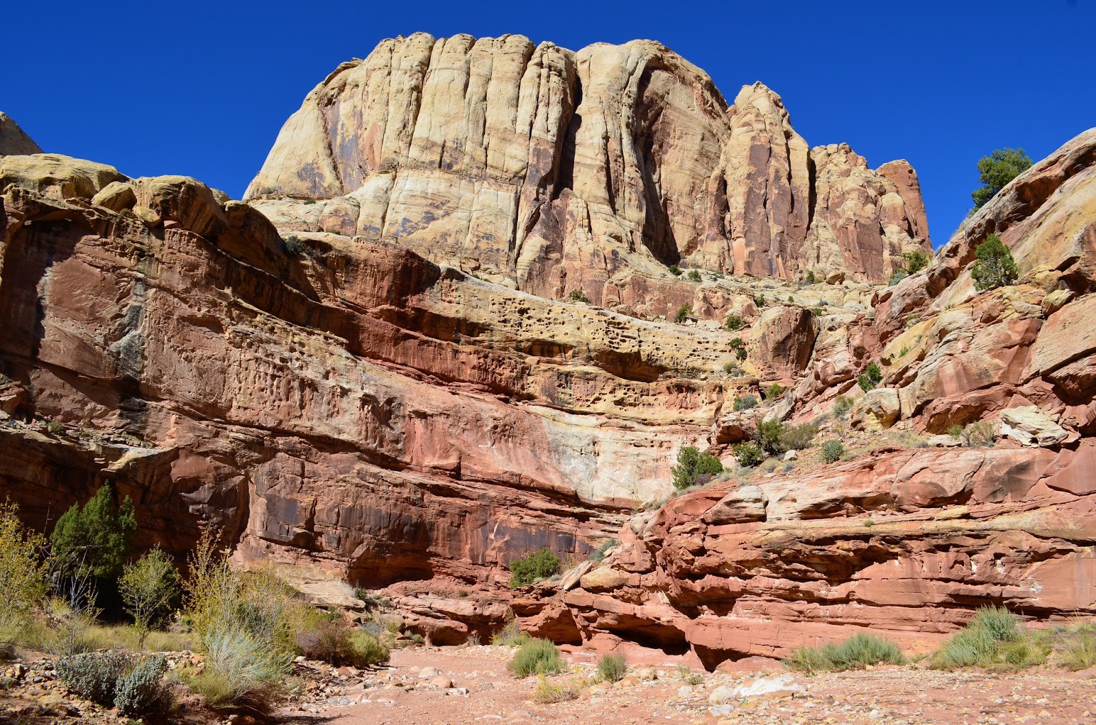


As we continued east on hwy 24 looking for a spot to turn around, we came across another roadside attraction...The Behunin Cabin.

 The Behunin cabin is a great example of what early settlers in Southern Utah lived in. The cabin, built by Elijah Cutler Behunin Cabin in 1883-1884 was renovated in the 1960's by the National Park Service to preserve it for future generations. The cabin was only lived in for a year before the Behunin family moved to Fruita, but illustrates the simplicity of a settlers home, and the resourcefulness of settlers to make do with what was available. The cabin is made with sandstone and cement plaster walls, and a wood and clay roof. It is humbling by today's standards to imagine a single person living in a 13 x 16.5 foot home (215 sq. ft.), let alone a family. Apparently Elijah lived here with his wife and 13 children! Yikes!
A little further up the highway we found a spot to turn around. We saw a cute little waterfall on the Fremont River...


Tomorrow we are due to leave but with the on-going leaky shower issue, we need to decide what we are going to do about that....
So Monday, we spent most of the morning researching on-line...Steve trying to find an RV repair place that had a bore scope camera in the nearest larger city, like St. George and Mesquite. I was trying to find a half decent RV park to stay in. Both of us were unsuccessful and finally came to the conclusion we need to go to a much more populated area with more repair options...so we decided on Las Vegas.
I forgot to mention earlier that although there is cell service in this area, our phone will not pick it up. This year we decided to give Roam Mobility a try. All we had to do was purchase a sim card in Canada, set up an account and we were good to go on our travels south. I think I had better reserve judgement since we have only been on the road less than 2 weeks...but so far, I'm not overly impressed with the coverage. Could be the more remote areas we have been in but I find it particularly frustrating when you see that there is cell service but we can only make "Emergency Calls" because the network is not recognized.
At least the RV park provided free WiFi, so we were able to do our research but every time we needed to make a phone call, we had to walk up to the office. At least they had a phone available. At one point when Steve was trying to call an RV repair facility in St. George, the office phone didn't work so the lady working there gave him her personal cell phone to use. Very nice folks...and a very nice RV park!
There are some nice hikes there, I know we enjoyed our time there. Did you get a pie at the Gifford house? If not you need to stop in and get one, very good!!!!
ReplyDeleteWe left some hikes for next time! Although very tempting, no we did not get a pie...I have a hard enough time with my waistline! LOL
DeleteSomething I learned recently, there are a number of reasonably priced borescope cameras that use the screen of a smart phone for display. Of course, I found this out after I spent $80 on a more conventional handheld scope. The tiny screen on my unit is a limiter, and I wished I could use my phone display.
ReplyDeleteThanks for the hike reports, looks like fun. Love Utah camping.
Thanks for the tip Kevin. One of the RV techs said he was thinking of getting the one for his phone. I just found the source of my leak, a crack in the shower pan. Waiting to here back on price and delivery for a replacement. May have to do a MacGyver on it.
DeleteLoved Hickman Bridge and the Grand Wash. great park and you got to be there for the fall color! Cedar Breaks us awesome too!
ReplyDeleteWe really enjoyed out time there! Love getting out on the trails again.
DeleteThanks for showing us areas we cannot see. Great pictures.
ReplyDeleteUtah is pretty awesome...hard to take a bad picture there!
Delete