Like so many of our travel days lately, we didn't have all that far to go...about 90 miles that would take us about an hour and a half. Check out time at Lost Dutchman State Park, our destination, is noon, so we didn't want to arrive before then.
It was going on 11:30 when we pulled out onto highway 77 north...a short distance later, we turned onto highway 79 north, taking us through Florence, home to multiple state, federal, county and private prisons (we passed three prisons on our drive through the city)...
Superstition Mountains in a bit of a haze...don't know if it is smog from Phoenix or just dust...
Superstition Mountains...
After some bad directions given to us by our GPS...Serena figured we should turn right onto East Lost Dutchman Blvd, instead of left toward highway 88 (North Apache Trail). Well the road quickly turned into a very rough gravel/dirt road. I turned to our alternate GPS option...Google Maps...and we were soon on our way. Thank goodness there was room enough to turn the rig around!
Road into Lost Dutchman State Park...the Superstition Mountains are absolutely beautiful (sorry for the wee bit of reflection from the window)...
We had reserved Site #45, so after a quick check-in, we were given a map and directions. Seems the majority of sites here are so-called "pull-throughs"...most of which from past experience are far too tight of a curve for us. Steve managed though, by going off the pavement and then backing the fifth-wheel back up onto it. Our preference for sites is back-in (as long as the road is wide enough for manoeuvring the truck)...we find they are usually larger and provide more privacy. Of course, "straight" pull-throughs are also a favorite, however they tend to be closer together. Our site worked out fine...I'm just glad that it wasn't a tighter curve! And the view out our back window is spectacular!
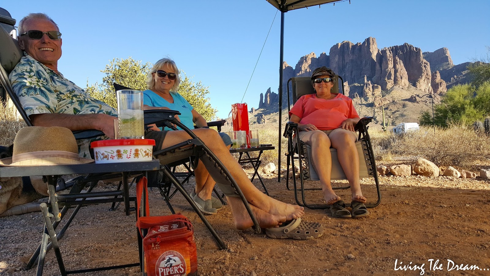
We got disconnected and all set up...and then it was time to head up to Deb and Ray's site...just 2 up from us. We enjoyed happy hour, catching up on the events since we parted a couple of weeks ago...
Just after 5:00 we piled into the car and headed about 5 miles back down the highway to
The Hitching Post Saloon. Ray and Deb had discovered it the other day and figured we would love it. They were right!
This is the parking lot on the other side of the building...made to look like an old western town...
We thought we would be early enough to grab a table inside...but no way, it was already packed! So we ended up sitting at a table outside.
There was live music tonight...Ron E Cash was playing and they had the place hopping! Good ol' country music!

A young couple even showed up on their horses...very cool! Deb insisted I get my picture taken with the fellow...yes, a real live cowboy complete with jingling spurs as he walked by. Unfortunately Deb's phone camera had a super bright flash that lasted forever and I ended up scowling when it finally took the picture...LOL
We enjoyed great beer and food! After the sun was down for awhile, a breeze also came up and it was quite chilly sitting outside...so it was time to head home. It felt like it should have been at least 9:30...it was only 6:30! LOL! A very fun evening!


 A young couple even showed up on their horses...very cool! Deb insisted I get my picture taken with the fellow...yes, a real live cowboy complete with jingling spurs as he walked by. Unfortunately Deb's phone camera had a super bright flash that lasted forever and I ended up scowling when it finally took the picture...LOL
Wow! You two are really brave to let your GPS guide you with a rig your size. I would be a mess. Even Google didn't drive the road you took because it turned to dirt. John has learned how valuable Google Street View is for us traveling when we had our tandam tow dolly with our motorcycle and car. There was no backing up and unhooking was a long processes. Thankfully,he still uses Google Street View to drive many of the secondary roads so we know exactly what to expect and what we will see at each corner so we don't miss a turn. Sometimes Google even drives into the RV Park so we can see exactly how wide the roads are. Glad you were able to get back on track without a problem.
ReplyDeleteThanks for the tip Pam, we'll give it a try.
DeleteClick and drag the little guy in the right corner of Google Maps Satellite view to the street you want to "drive." Then scroll as you actually drive down the road you want to travel. We've seen the Google car in a few different places across the country. Once, it was taking the ferry from Kingston, ON to Wolf Island with us. It is SO helpful in allowing you to see intersections, if there is a shoulder on narrow roads, the entrance drive to parks, etc.
DeleteThe Superstitions are a favorite of ours! We go to Lost Dutchman every March. So many hiking trails all around there and a lot to do. Are you going to hike Flat Iron? That tall iron shaped peak with the white band running through it? A great, challenging hike!
ReplyDeleteThis is our first time at Lost Dutchman SP. The mountains are stunning! Looking forward to some hiking but I don't think we're ready for Flat Iron!
DeleteWe had such fun. More adventures to come. :)
ReplyDeleteLooking forward to it!
DeleteWe are really looking forward to seeing Lost Dutchman in February. What views!!
ReplyDeleteSounds like you four are going to have a great time there.
Have fun and be safe!
Views are fabulous! You'll enjoy it.
Delete